Lake Conroe
After the record-breaking seven-year drought in the 1950s, a plan was made to construct Lake Conroe as part of a reservoir-building boom. After the drought, the state decided to build several reservoirs to prevent from having such severe water shortages ever again. This is the reason that most of the existing reservoirs in Texas were built.
The San Jacinto River Authority (SJRA), previously called the San Jacinto Conservation and Reclamation District, was formed by the State of Texas Legislature as a way to manage the Lake Conroe watershed. The San Jacinto Conservation and Reclamation was formed in 1937 and in 1951 the name was officially changed to the San Jacinto River Authority. The purpose of the SJRA is to develop, conserve, and protect the water resources of the San Jacinto River basin.

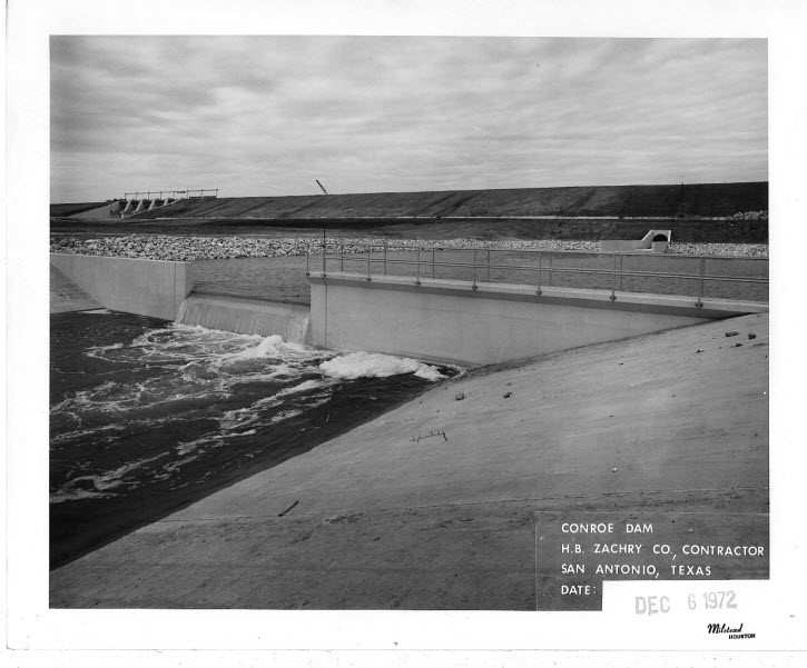
Lake Conroe Dam and Weir Pond Construction in 1972 (credit: San Jacinto River Authority)
During the first few years, from 1937 -1941, SJRA dedicated the majority of its resources to providing soil conservation services to help farmers and ranchers build stock tanks, ponds, and small lakes that helped control storm water runoff and erosion. In 1946, SJRA took part in a long-range program of soil conservation and land reclamation in order to help improve the area’s agriculture and to prevent negative impacts to the watershed that could develop from soil erosion.
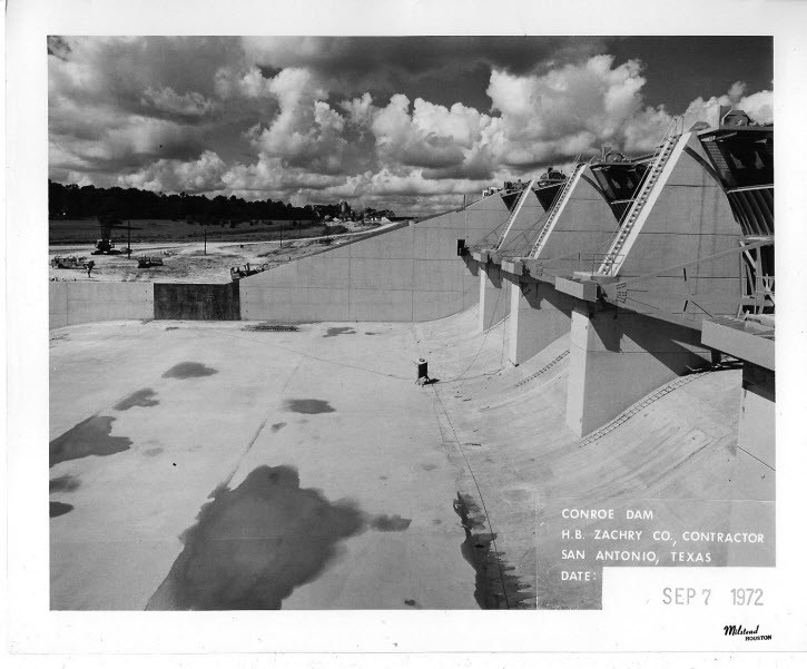
Fulfilling SJRA’s main goal and purpose of water supply development led to an agreement between SJRA, the City of Houston, and the Texas Water Development Board to construct Lake Conroe as a water supply reservoir in 1968. The dam which holds the water inside the reservoir was completed in January, 1973, and the lake was filled ten months later in October.
Lake Conroe encompasses a 21,000-acre area and extends nearly 21 miles from the dam to the upper reaches of the West Fork of the San Jacinto River. The lake can hold up to 430,000 acre-feet of water when at its conservation pool elevation of 201 feet.
In addition to its purpose of being an alternative source of water for the City of Houston, Lake Conroe also began to help supplement groundwater in Montgomery County as a source of drinking water in September 2015. SJRA has made voluntary agreements with more than 80 public and private entities in Montgomery County in order to build a water treatment facility that uses surface water from Lake Conroe. This system provides a surface water alternative to groundwater in the county.

Construction of Lake Conroe Dam in 1972 (credit: San Jacinto River Authority)
Lake Houston
Lake Houston, located in eastern Harris County, is owned by the City of Houston and is maintained by the Coastal Water Authority (CWA). The two entities made an agreement in 1996, which called for the CWA to operate the Lake Houston pump station. CWA moves the water from Lake Houston to the Northeast Water Purification Plant.
In 1951, the building of the Lake Houston dam began and it was finished just two years later in 1953. In 1970, adjustments were made to help with erosion control work. Lake Houston is similar to Lake Conroe in that it is man-made. The purpose of building Lake Houston was to help provide drinking water to the City of Houston. To this day, supplying drinking water remains its main purpose. Unlike Lake Conroe, Lake Houston has very minimal commercial developments and recreational sites nearby. There are few public access points along the lake and hardly any restaurants. The lake is primarily used by fisherman rather than for recreational activities. Today Lake Houston is the number one source for the City of Houston’s drinking water supply.

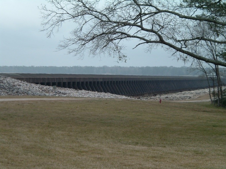
Lake Houston Dam (credit: Coastal Water Authority)
A statistical comparison of Lake Conroe and Lake Houston
Lake Conroe
- Surface acres: 19,640
- Watershed drainage area: Approximately 450 square miles
- Capacity: 412,200 acre feet.
- Average depth: 20 feet.
- Normal pool elevation: 201 feet above mean sea level
Lake Houston
- Surface acres: 11,282 acres
- Drainage basin: Approximately 2,828 square miles (445 square mile controlled by Lake Conroe Dam)
- Capacity: 134,122 acre feet.
- Average depth: 12 feet
- Normal pool elevation: 42.5 feet above mean sea level
To learn more about the history of Lake Conroe and the SJRA’s Lake Conroe Division, please visit https://www.sjra.net/lakeconroe/history/#iLightbox[gallery_image_1]/18.
To learn more about the Coastal Water Authority and its maintenance and operations of Lake Houston, please visit https://www.coastalwaterauthority.org/locations/lake-houston.
To learn more about the history and statistics of Lake Houston, please visit http://www.twdb.texas.gov/surfacewater/rivers/reservoirs/houston/index.asp.
One of the major river authorities in Texas, SJRA’s mission is to develop, conserve, and protect the water resources of the San Jacinto River basin. Covering all or part of seven counties, the organization’s jurisdiction includes the entire San Jacinto River watershed, excluding Harris County. For additional information on SJRA visit our website at www.sjra.net, like SJRA on Facebook @SanJacintoRiverAuthority, follow us on Twitter @SJRA_1937, find us on Instagram @sanjacintoriverauthoritySJRA, or connect with us on LinkedIn @San Jacinto River Authority.
Sources:
https://www.twdb.texas.gov/surfacewater/rivers/reservoirs/houston/
https://tshaonline.org/handbook/online/articles/rol42
https://www.coastalwaterauthority.org/locations/lake-houston

