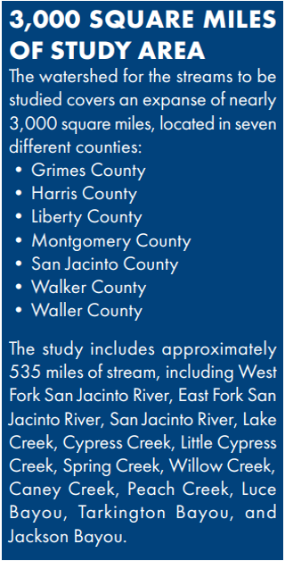
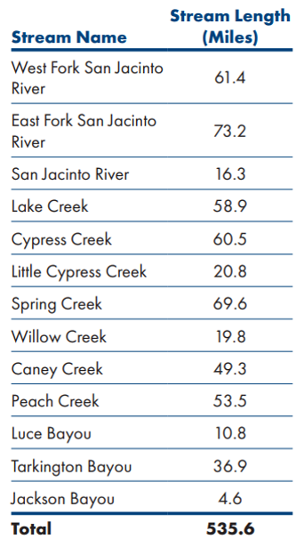
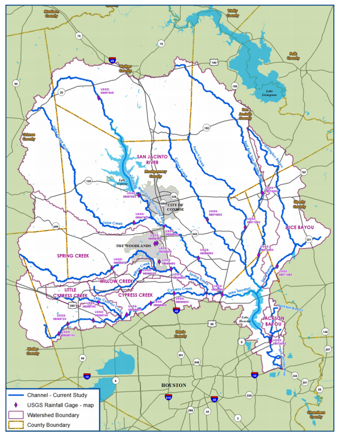
SJRA and three other local partners (Harris County Flood Control District, Montgomery County, and the City of Houston) are diligently working on the San Jacinto Regional Watershed Master Drainage Plan (SJMDP). The SJMDP is a comprehensive regional Plan that “aims to provide an up-to-date technical basis to identify flooding vulnerabilities for future growth and improve flood resiliency within the San Jacinto River regional watershed.”
Date SJMDP kicked off:
- April, 2019
Goals of the SJMDP:
- Identify the region’s vulnerabilities to flood hazards using Atlas 14 rainfall
- Develop approaches to enhance public information and flood level assessment capabilities during a flood disaster event
- Evaluate flood mitigation strategies to improve community resilience
- Provide a comprehensive Flood Mitigation Plan that supports the needs and objectives of each regional partner using consistent methodology
Funding for the SJMDP:
- Funded jointly with 75% from the Federal Emergency Management Agency Hazard Mitigation Planning Program, conveyed through the Texas Department of Emergency Management and 25% from the four local partners.
Information to be developed:
- Non-regulatory inundation maps (not intended to replace current effective maps) for the studied streams that show the extent and depth of riverine flooding of the larger rivers within the watershed for an array of simulated storm events.
- Additionally, information will be gathered about the number of structures, acres of land, properties, and miles of roadway that are located within the modeled floodplains.
Purpose of the SJMDP:
- SJMDP results will be used to inform and update Hazard Mitigation Plans for each of the participating partners and to provide guidance on regulations for future growth within the study area.
For more information on the Plan, visit www.sanjacstudy.org.
Fact Sheet
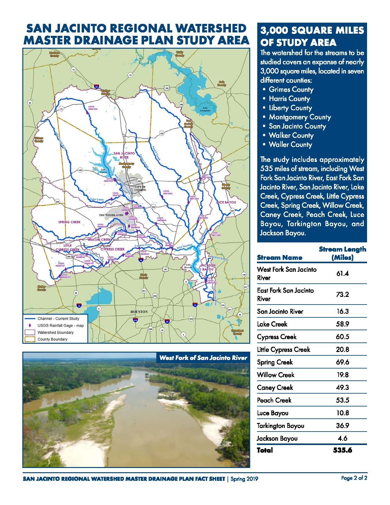
Study Area
